Do not hesitage to give us a call. We are an expert team and we are happy to talk to you.
+09736971825
Arrive at Kasol by early in the day, as this is where the hike will begin.
Set out from Kasol on the trip to Grahan village. The walk takes four to five hours.
Travel through lovely pine forests while taking in the tranquil settings.
A tough hour-long ascent will get you to Grahan hamlet, at an elevation of around 7,700 feet.
At Grahan village, set up your tents for the night and get some rest.
Ascend northward from Grahan village to start the day’s journey.
You will see a number of picturesque locations on this day, such as Min Thach, Nagaru, and Sar Top.
As you enter the woods and are encircled by lush vegetation, the path gets steeper.
Reach Min Thach, which provides amazing views of the Chandrakhani stretch and other mountain ranges, after a few hours of hiking.
Camp for the night at Min Thach and take in the area’s breathtaking natural scenery.
Set out on your journey towards Nagaru from Min Thach. The walk takes four to six hours.
You will be treated to breathtaking views of the Parvati Valley and the town of Manikaran as you walk through the trees.
Aim for the Nagaru campground, situated at an elevation of around 12,500 feet.
You can take in the stunning mountains that encircle the region from Nagaru.
Prepare for the trials of the next day by getting a good night’s sleep at Nagaru.
Start your day early since you have a difficult one ahead of you. It would take about 6 to 8 hours to reach Sar Pass if you begin ascending the steep snow.
Ascend Sar Pass and enjoy the breath-taking, all-encompassing vistas of the neighbouring peaks and valleys.
Once you’ve taken in the breathtaking vista, slide down the snow-covered slopes to reach the Biskeri Thach campground.
Stay the night at Biskeri Thach, which is encircled by enormous grasslands, mountains, and pine trees.
You will walk down from Biskeri Thach on this day. The trail may have fences in places and has some steep sections.
You will cross a stream and thick trees on your journey to Pulga settlement.
After arriving in Pulga, proceed to Barshaini village by way of the Parvati River bridge.
The adventure’s base camp, Kasol, awaits your return following your completion of the Sar Pass hike.
You can finish the hike and head out of Kasol once you get there.
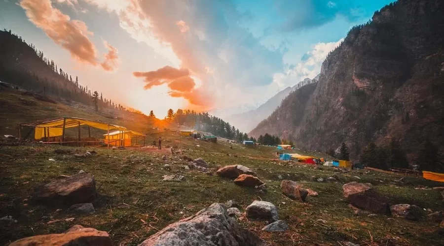
Kasol Base Camp
Note: Depending on a person’s level of fitness, the weather, and other variables, the trek’s length and intensity may change. For a safe and enjoyable experience, it’s always advised to be well-prepared, carry the necessary equipment, and speak with knowledgeable trekking guides or tour operators.
The Parvati Valley of Himachal Pradesh, India is home to the high-altitude mountain pass known as Sar Pass. Approximately 4,220 metres (13,845 ft) above sea level is where it is located. Popular trekking destination Sar Pass is renowned for its breathtaking scenery and difficult terrain.
Most treks to Sar Pass start from the popular tourist resort of Kasol village. Kasol, also referred to as “Little Israel,” is a popular travel destination for Israelis because of its vibrant hippy culture, gorgeous surroundings, and laid-back vibe. The village of Kasol, which is tucked away next to the Parvati River, is even more picturesque because of the breathtaking views of the surrounding mountains.
A multi-day trip across meadows, snow-covered landscapes, and dense forests is the Sar Pass hike. The walk provides breathtaking views of lush green valleys, gushing waterfalls, and snow-capped summits. The Sar Pass walk is rated as moderately challenging, requiring hikers to possess strong physical conditioning and endurance.
There are a number of campsites throughout the route, including as Grahan, Ratapani, Biskeri Thatch, and Nagaru. Trekkers can relax and refresh at these campgrounds, which provide rudimentary amenities. The adventure and excitement of the expedition are increased by having to cross a snow-covered steep slope.
The best months to walk the Sar Pass are normally May through June and September through October for those who intend to do so. Because the snow has melted and made navigation easier, the trails are typically more accessible during this time of year. The weather can change, so before deciding on your hiking itinerary, it’s a good idea to check the area forecasts and speak with knowledgeable hikers or tour operators.